The original inhabitants of the Dampier Archipelago were the Yaburara people who were massacred over an eight day period in February 1868. This genocide occurred at various locations on the Burrup and in the waters of the Archipelago in what is referred to as the Flying Foam Massacre. The current claimants/custodians are the Ngarluma Yindjibarndi, Wong-goo-tt-oo and Yaburara Mardudhunera peoples.
![]()
![]()
![]()
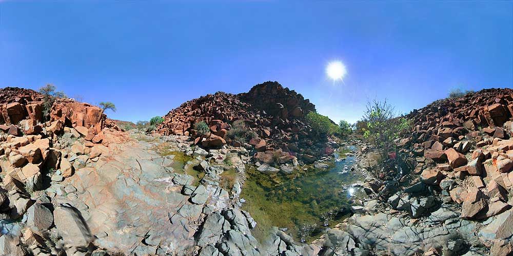
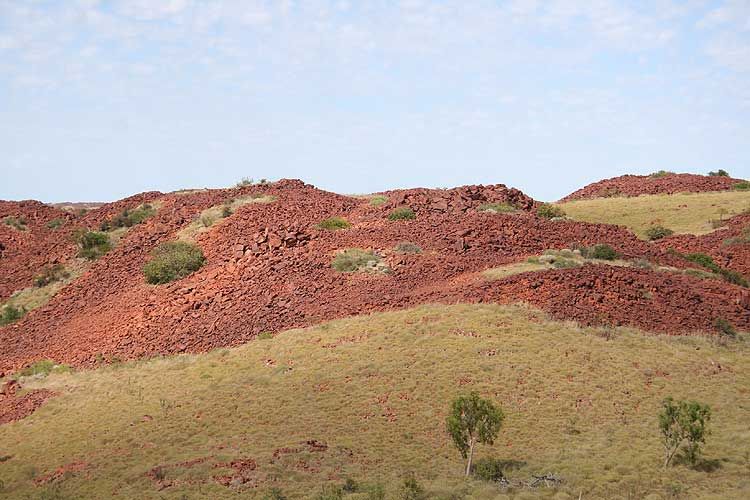
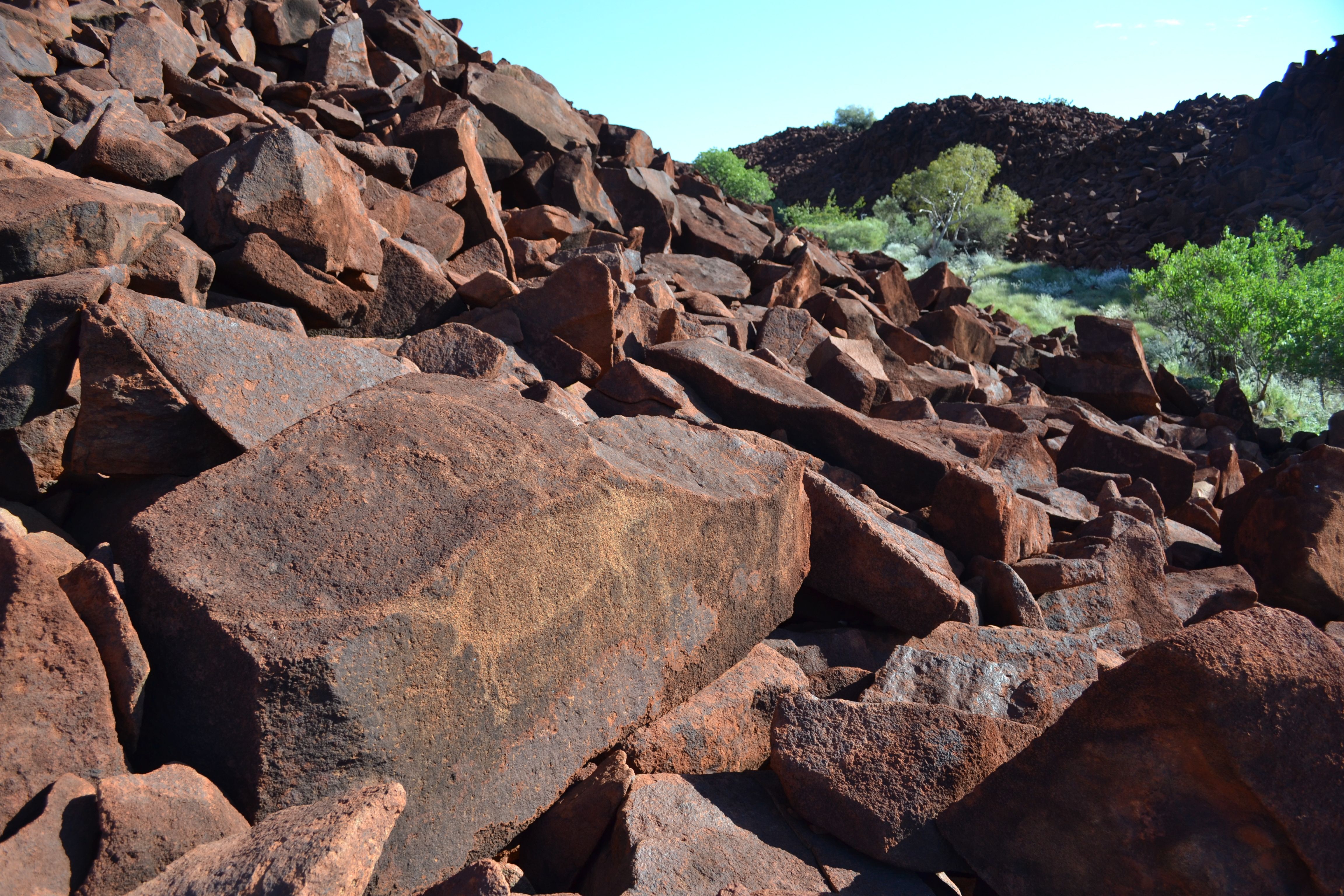
The Burrup Peninsula (or Murujuga) is a unique ecological, spiritual and archaeological area since it possibly contains the world’s oldest, largest and most important collections of petroglyphs and ancient rock carvings. The peninsula is part of the Dampier Archipelago which is comprised of 42 islands in a 45km radius. The Burrup Peninsula, approximately 27km long and 5km wide, was originally an island that formed part of this grouping until it was joined to the mainland in the mid-1960s by a rail and road causeway built by industry.
The Burrup Peninsula is located on the north-western coast of Western Australia on the Dampier Archipelago.
All visitors must follow and respect the Murujuga general and cultural protocols for visitors.
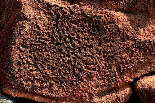
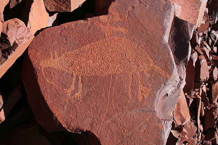
Dampier Rock Art Precinct comprises possibly the largest concentration of petroglyphs (rock carvings) in the world and possibly the largest number of megaliths (stone arrangements) known in Australia. Estimates of the number of rock art motifs range from 300,000 to well over 1,000,000 images. There are many types and styles of carvings in the Archipelago, which are thought to represent a period from our recent history up to 40,000 years in age, straddling the last ice age some 17,000 years ago. The place constitutes the greatest continuous cultural site in Australia.
The Archipelago is also a site of great aesthetic attributes, visual and non-visual, being the place where the magnificent hills of the Pilbara meet the Indian Ocean. It has considerable value as a geological showcase and it is home to three endangered animal species and 39 endangered or endemic plant species. It has impressive marine life (dugong, turtle beaches and whale nursery) and wetland areas. But its significance as Australia’s largest monument to Indigenous culture completely overshadows all its other qualities. Its importance to Australia and the world is apparent by the fact that it meets all of the nine criteria for World Heritage listing.
Petroglyphs are numerous in many other parts of Australia, but nowhere do they even remotely approach those of Dampier in terms of number, history, variety or continuity. The rock art of the Archipelago remains an important cultural focus for Aboriginal people in the region, comprising as it does thousands of sacred images and ceremonial sites (e.g. tharlu increase sites). It remains an utterly sacred place not only to the local Indigenous communities, but also for all Australians and, indeed, all people. This quintessentially Australian and entirely unique cultural property needs to be included on the World Heritage List. It is a place of unparalleled artistic, cultural, religious and historical significance, as well as a place of magnificent natural beauty.
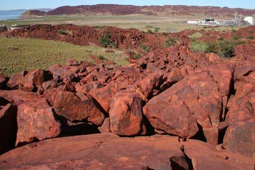
In 1962-64 the Western Australian Government determined to use Dampier Island (Burrup) in the Dampier Archipelago as the location of an outlet port for the iron ore industry. It did so seemingly on the basis of an incorrect report from the WA Museums department that had indicated that there were only 200 carvings in the Dampier Archipelago. By 1973, Enzo Virili had recorded 6,000 carvings on the Burrup in a 5 square mile area and 4,000 of these were in Gum Tree Valley alone. No further evaluation, that has been sighted, was ever carried out into the suitability of this area for industrial development, either based on site costs, environmental or heritage values.
There have been a number of reports into planning for industrial development of the Dampier Archipelago, none of which, until the latest reports to the federal minister, have addressed the industrial conflicts in one of human kind’s earliest and most significant heritage sites. Even with today’s knowledge of the international importance of the area, the State government continues to invest in industrial infrastructure on the Burrup, stating that they are on track to turn the Burrup into the main industrial hub for the Asia Pacific region.
Lieutenant General John Sanderson, who was the State government’s Indigenous Affairs Special Adviser stated in answer to questions about protecting the rock art, “Absolutely. I mean this is an amazing collection of art. We are talking about tens of thousands of pieces of art, 20,000 years old carved in granite. Most Australians would watch the television shows and think that it was a few primitive scratchings on rock. We are talking about an ice age culture, we are talking about Aboriginal temples in the rock.”
The current industrial footprint is 16 sq km out of the 117 sq km of the Burrup, though current leases cover a much larger area. In the footprint area at least 10,000 petroglyphs have already been destroyed. State land use planning has defined that an area of only 49.3 sq km (44%) is to be protected from industry. This protected area is to be opened up, have a road driven through it and turned into a tourism and recreation area.

© 2023 Friends of Australian Rock Art (FARA)
C/- Conservation Council of WA Inc.
City West Lotteries House
2 Delhi Street, West Perth, WA 6005